Isosurface Computation and Display

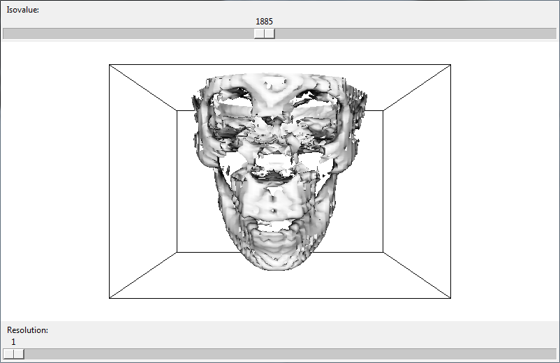
The purpose for this project was to visualize interactively isosurfaces of a 3D dataset for three levels of resolution. Using the provided datasets, I extracted and rendered an isosurface. I also added two user interface components that allow a user to change the isovalue of the isosurface and level of resolution of the dataset.

You might be interested in …

Multi-Resolution 3D View

3D terrain visualization program which loads a terrain map file containing unsigned chars. The terrain switches to a half resolution version based on the distance from the viewer. The boundaries between the full and half resolution terrain are “stitched” so that no “holes” are visible in the terrain. The user may navigate through the scene […]

Read More

Hatching Shader

This is a shader implementation of Real-Time Hatching, Praun et al. [2001]. The scene contains a real-time rendering of hatching strokes over various objects. They use tonal art maps containing different stroke sizes and density at various resolutions. Using these tonal art maps, we can render strokes on complex surfaces.

Read More

Sandboxr

Created using the Unity Game Engine for the company Sandboxr. I was hired as a Graduate Research Assistant to help the company create its application. The founders wanted an application that would allow them to import 3D objects that they would then arrange in 3D space. Password: sandboxr

Read More