Multi-Resolution 3D View

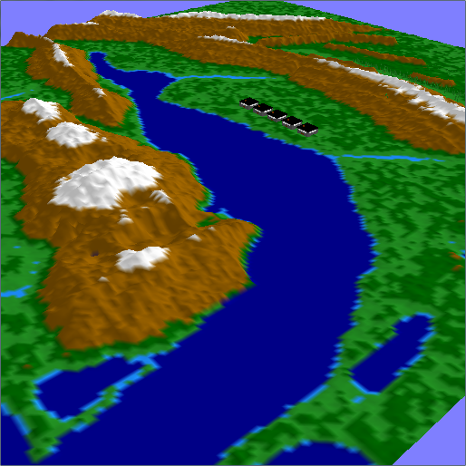
3D terrain visualization program which loads a terrain map file containing unsigned chars. The terrain switches to a half resolution version based on the distance from the viewer. The boundaries between the full and half resolution terrain are “stitched” so that no “holes” are visible in the terrain. The user may navigate through the scene using keyboard and mouse input.

You might be interested in …

Shadow Algorithms

The scene contains a 4-sided room that are light-colored blue. Within this scene are various objects included a texture-mapped sphere and several stacked objects. There are 3 different shadow algorithms being used: projective shadows, shadow volumes, and shadow maps. Projective shadows from objects will only cast shadows on the floor and room, but not on […]

Read More

Texture Mapping

Texture mapped a 4-sided room such that one wall has front-side culling applied. The floor is texture mapped using a checkerboard image and also feature mip mapping. The walls of the room are a repeated brick texture. There is a floating sphere in the center of the room texture mapped with the image of the […]

Read More

Particle Systems

A particle system that uses an attractor force that pulls particles to a respective position in space. These positions were based on vertex positions from an obj file.

Read More